Connect this guide with the rest of your visit in the Islamabad trip planner. Read how the research is made and what its sources establish.
At a glance
Start here
- Islamabad occupies a plateau edge below the Margalla Hills rather than a flat blank site.
- The national park includes more than the visible ridgeline; official notifications also encompass Rawal Lake and named village lands.
- Urban parks, planted green areas and protected habitat have different purposes and managers.
- Wildlife lists are evidence of habitat, not promises of a sighting.
01
Start with the plateau edge
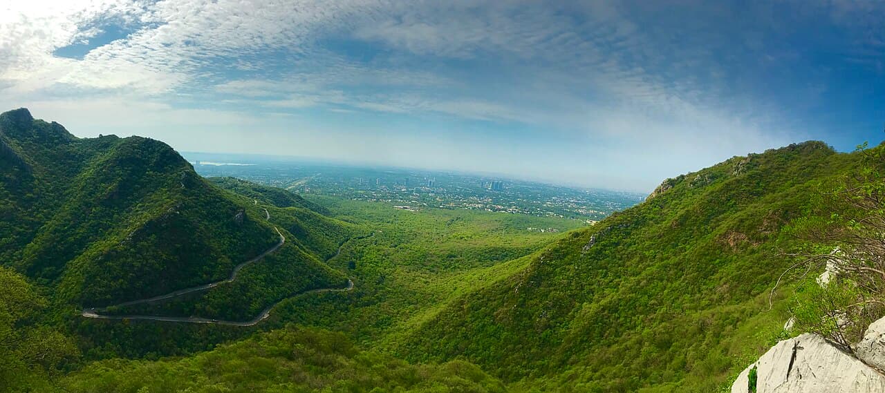
CDA places Islamabad on the northeastern fringe of the Potohar Plateau and gives an official altitude range that rises toward the north. Its history says the site-selection commission considered climate, water, aesthetics and the Margalla setting. This terrain helps explain why the city's long views, drainage lines and northern horizon feel different from a purely level grid.
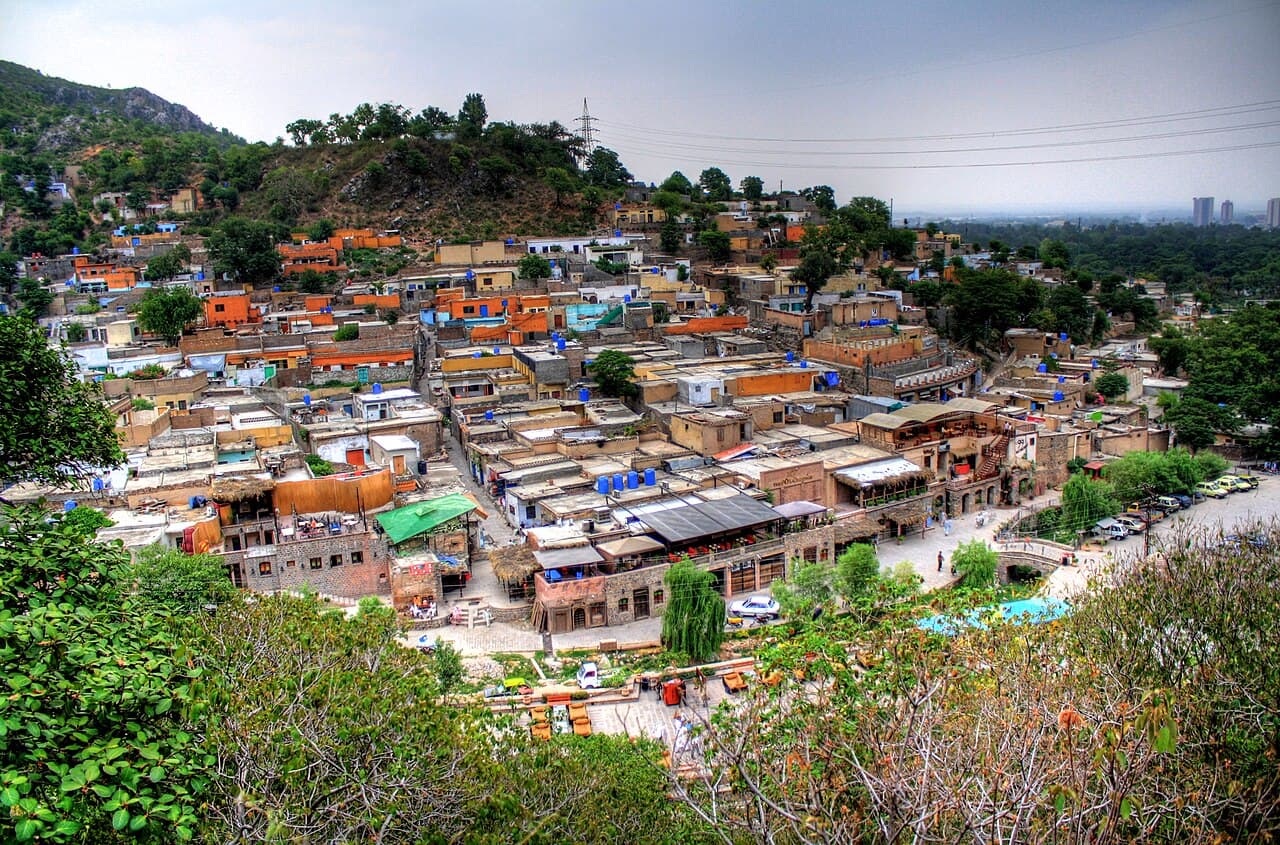
Read a public viewpoint in layers. The near layer may be designed landscaping or a sector. The middle distance contains built corridors, Shakarparian and water. The northern frame is the Margalla range. Do not turn that visual sequence into a geological claim without a geological source; the useful observation is that the planned city occupies and responds to a pre-existing landform. The grid sits on terrain rather than replacing it.
Sources: Capital Development Authority; Capital Development Authority02
The national park is a system, not a skyline
The 1980 declaration compiled on CDA's legal page places the Margalla reserve forest and other lands in the national park. It also lists named villages, including Saidpur, and Rawal Lake plus an area extending from its highest water mark. That legal geography is broader than the ridges most visitors photograph.
This wider boundary links hills, settlement edges, water and lowland habitat. It does not mean every part is a recreational area or that identical visitor rules apply throughout. Treat the notification as evidence of protected scope, then use current managing-authority information for access and conduct. A lake shore, forest slope and village land can belong to one protected system while requiring very different behaviour.
Sources: Government of Pakistan via Capital Development Authority03
Separate a national park from an urban park
CDA's environmental wing distinguishes forest and national-park management from the Parks Directorate, which maintains major urban parks, tracks, landscaped areas and play facilities. Fatima Jinnah Park, Lake View Park and Shakarparian appear in the parks portfolio, while forest protection, fire control and afforestation belong to another operational layer. The categories can overlap geographically without becoming identical.
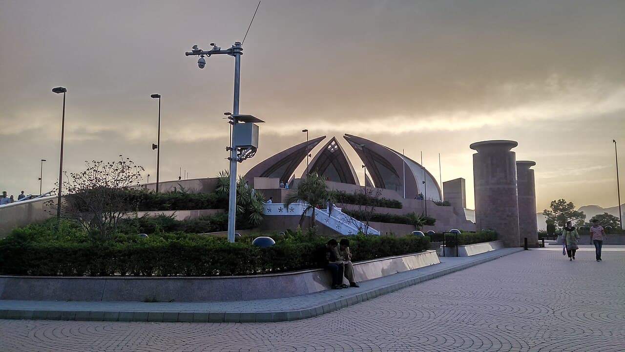
Use precise language in notes and captions. A lawn in F-9 is maintained urban green space. A planted avenue is landscape infrastructure. Margalla habitat is protected ecosystem. Rawal Lake combines water, recreation and park context. Precision helps visitors understand why leaving litter, disturbing vegetation or expecting amusement-style facilities everywhere is inappropriate. It also reveals how much human maintenance Islamabad's “green” appearance requires.
- Urban green space: designed and maintained for civic use.
- Protected habitat: managed for ecological conservation under law.
- Watershed: land whose soil and drainage affect a water body.
- Viewpoint: visitor infrastructure within a larger landscape.
04
Follow water through the landscape
CDA's environment page identifies soil-conservation work in the Simly Dam catchment and assigns the clearance of nullahs and streams across city functions. The master-plan review discusses decreasing surface water in its account of land-cover change and calls water a resource requiring conservation. Rawal Lake is also part of the national-park notification and a recreational destination in CDA's visitor material.
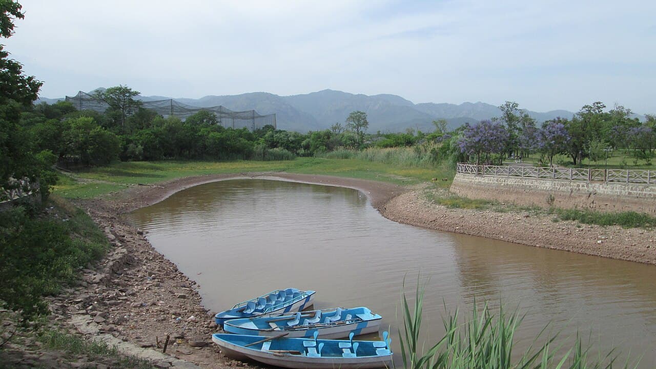
Together these sources show why water cannot be reduced to a lake-view photograph. Rain moves through slopes, soil, drainage channels and built areas before it becomes a reservoir or flood problem. From a lawful public place, look for changes in ground level, channels, planted edges and hard surfaces. Do not enter a nullah or infer water quality from appearance. The point is to see the capital as a catchment as well as a street plan.
Sources: Capital Development Authority; Capital Development Authority; Government of Pakistan via Capital Development Authority05
Biodiversity is more than a leopard headline
IWMB's research page reports surveys covering hundreds of plant species and substantial mammal, bird, reptile and amphibian diversity in Margalla Hills National Park. Those totals communicate ecological range; they do not promise that a visitor will see a rare, elusive or nocturnal animal.
A better way to read biodiversity is through habitat signs: vegetation layers, water, dead wood, bird calls and transitions between edge and forest. Never approach, feed or pursue wildlife for a photograph. Record a sighting cautiously and leave identification uncertain when key features were not visible. The park's value does not depend on producing a dramatic encounter during one outing.
Sources: Islamabad Wildlife Management Board06
Conservation is active work
IWMB describes field monitoring, habitat protection, invasive-plant removal, fire management, action against illegal wood extraction and research into human-wildlife conflict. CDA likewise lists forest protection, fire control, afforestation and soil conservation. The green landscape visible from the city is therefore governed, monitored and repaired; it is not a self-maintaining scenic reserve.
The list of invasive plants on IWMB's page also shows why “more greenery” is not a complete ecological measure. Species composition matters, as do habitat connection, fire, grazing and human pressure. Visitors should not undertake their own removal or intervention. Follow current park direction, stay within authorised public use and report concerns through the responsible body rather than acting on a social-media identification.
- Monitoring establishes change over time.
- Fire management protects habitat during a defined seasonal risk.
- Invasive removal concerns species composition, not just green cover.
- Community and wildlife pressures require management beyond visitor rules.
07
Make an editorial landscape transect
To see the system without creating another hiking guide, choose three lawful public observations on separate outings: a sector green area, a Shakarparian or Rawal Lake public space, and a designated Margalla viewpoint. At each, note ground form, planted versus spontaneous vegetation, water movement, built edges and the managing body named on signs. Do not leave marked public areas or assume access.
Compare the notes by scale. Which elements are designed? Which belong to protected habitat? Where does water connect the scene? What maintenance is visible? Use a current official forecast because rain and visibility change what can responsibly be observed, but do not claim a season is universally best. The outcome is a map of relationships, not a ranking of photogenic locations.
Sources: Capital Development Authority; Capital Development AuthorityUseful answers
Reader questions
Is all of Islamabad's greenery part of Margalla Hills National Park?
No. CDA distinguishes urban landscaping and major parks from forest and national-park management. Some areas connect spatially, but a sector green belt, an urban park and protected habitat are not the same category.
Sources: Capital Development AuthorityDoes Margalla Hills National Park include Rawal Lake?
Yes. The 1980 declaration in CDA's legal compilation places Rawal Lake and an area measured from its highest water mark within the national park.
Sources: Government of Pakistan via Capital Development AuthorityDo high wildlife totals mean I will see rare animals?
No. IWMB's survey totals describe the park's biodiversity, not the likelihood of an encounter on one visit. Use the totals as a record of ecological breadth, not an encounter forecast.
Sources: Islamabad Wildlife Management BoardWhy does the city manage soil and catchments as environmental work?
CDA links soil conservation in the Simly Dam catchment with water quality and ecosystem health. Slopes, soil, streams and reservoirs form connected systems rather than separate scenery.
Sources: Capital Development AuthorityRead the evidence
Sources and further reading
These sources support the relevant sections above. Plans and comparisons are editorial suggestions. Check operators for current arrangements.
- CDA-About Islamabad ↗Capital Development Authority · Research date 14 September 2026
Islamabad's position on the Potohar Plateau, altitude context and landscape criteria in capital-site selection.
- Interim Report on the Review of Master Plan of Islamabad (2020–2040) ↗Capital Development Authority · Research date 14 September 2026
The original integration of nature and city, national-park role, surface-water discussion and conservation framing.
- The Islamabad Wildlife (Protection, Preservation, Conservation and Management) Ordinance, 1979 ↗Government of Pakistan via Capital Development Authority · Research date 14 September 2026
The 1980 declaration's inclusion of reserve forest, named village lands and Rawal Lake within Margalla Hills National Park.
- CDA-Enviromental Protection ↗Capital Development Authority · Research date 14 September 2026
Distinct responsibilities for urban green areas, parks, forests, fire control, afforestation, soil conservation and waterways.
- Research & Planning ↗Islamabad Wildlife Management Board · Research date 14 September 2026
Official biodiversity survey totals, research themes and identified ecological management challenges.
- Wildlife ↗Islamabad Wildlife Management Board · Research date 14 September 2026
IWMB's monitoring, fire control, invasive removal, habitat protection and enforcement work.