Connect this guide with the rest of your visit in the Islamabad trip planner. Read how the research is made and what its sources establish.
At a glance
Start here
- The capital-site commission preceded the 1960 master plan and CDA's statutory development role.
- Sectors were conceived as neighbourhood communities, not just square address boxes.
- Blue Area and national institutions served different functions within the plan.
- The official 2020 review records both the plan's ambition and substantial implementation gaps.
01
The decision came before the grid
CDA's planning history says the Federal Capital Commission was established in 1959 and Doxiadis Associates was appointed as consultant. CDA's broader account describes the site-selection work beginning in 1958, with location, climate, logistics, defence, aesthetics and natural beauty among the criteria. The master plan was approved by the federal cabinet on 26 October 1960. These stages matter because “Doxiadis designed Islamabad” can otherwise sound like a single architect drew a city on empty land without a state commission, regional setting or political purpose.
The selected site was northeast of the older garrison city of Rawalpindi on the Potohar Plateau at the Margalla foothills. The plan therefore began with a relationship: a new administrative capital beside an existing city and within a recognisable landscape. That relationship would later prove harder to manage than a clean plan drawing suggests.
Sources: Capital Development Authority; Capital Development Authority; Capital Development Authority03
The sector was meant to be a community
CDA's current planning page calls each sector an independent neighbourhood community. The 2020 review goes further: it describes a roughly two-by-two-kilometre module, a markaz for central facilities, smaller local centres and an intended hierarchy of public spaces. The design ambition was social as well as geometric. A sector was supposed to organise daily needs and human-scale community inside a repeatable frame.
That makes the modern shorthand—F sectors are this, G sectors are that—too crude for understanding the plan. The letter-number system is the visible shell. The deeper proposition was that housing, services, commerce and public space could be structured as a neighbourhood unit while the city expanded. When visiting a markaz, a local shopping area and a residential edge, look for that hierarchy. The degree to which it works is an observation, not something the plan itself can guarantee.
Sources: Capital Development Authority; Capital Development Authority04
Blue Area was a spine, not another centre
The official review describes Blue Area as a linear central business district intended to grow with the city. It separately identifies land for the diplomatic enclave, administrative functions, public buildings, special institutions and light industry. This division of functions explains Islamabad's unusual experience of moving between concentrated national institutions, a long commercial corridor and quieter sector centres rather than encountering one inherited downtown.
The visitor can read this in ordinary public settings. Compare building scale, setback, road width and public use along a commercial segment and a sector markaz. The point is not that functional separation is automatically good. It is that the city's emptier transitions and long road movements partly arise from deliberate land-use organisation. Later growth has added complexity, but the original categories remain legible.
Sources: Capital Development Authority; Capital Development Authority05
Nature was treated as urban structure
The 2020 review interprets the original plan as integrating landscape and townscape rather than adding isolated gardens after construction. It describes nature infiltrating the settlement at different scales and identifies the national park as a constituent part of the metropolitan idea. CDA's environmental page now divides responsibility across sector green areas, Shakarparian, major parks, forests, viewpoints and watershed work.
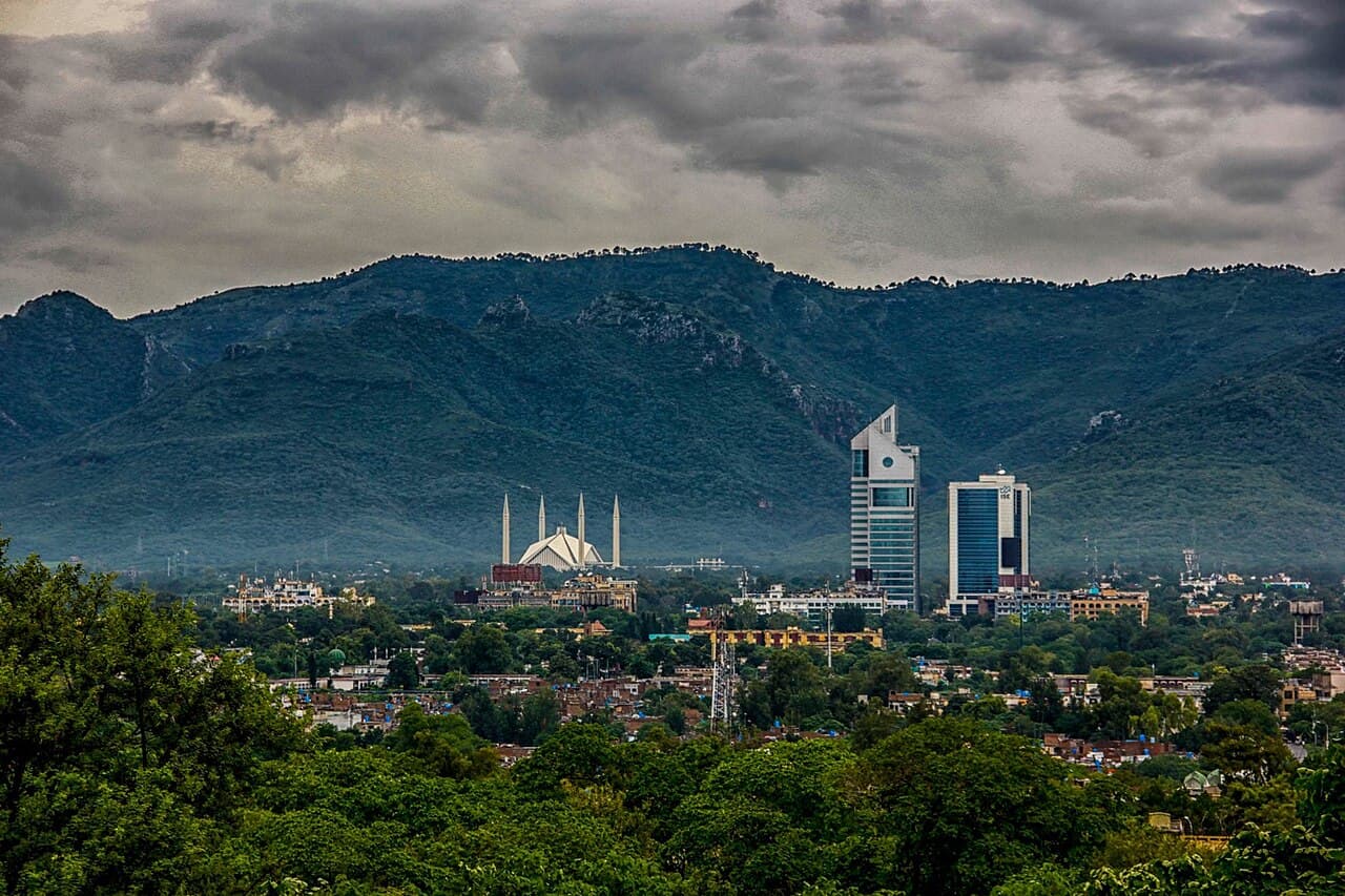
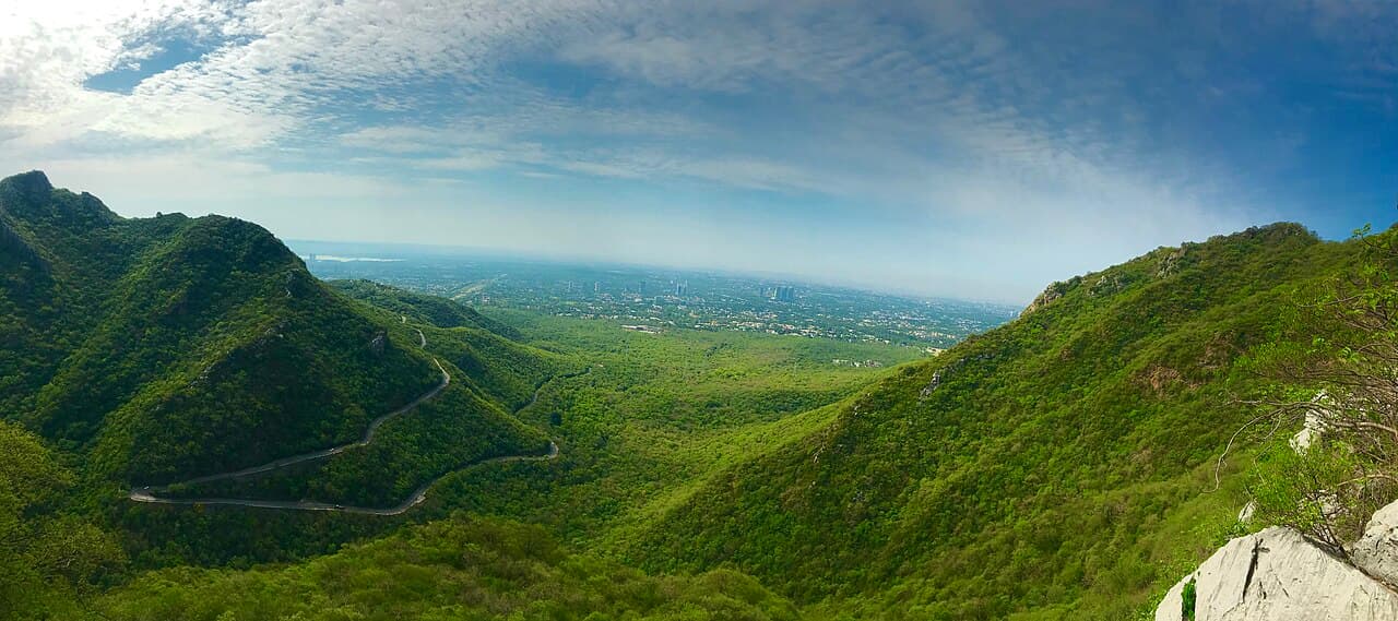
This is why Islamabad's green identity is more than the Margalla skyline. Median planting, park systems, green areas between sectors, Shakarparian and protected hills belong to different layers of management and ecology. A photographed green belt may be designed landscape; a national park is a protected ecosystem; a historic village is a lived settlement. Calling all three “nature” erases the planning choices and conservation obligations that distinguish them.
Sources: Capital Development Authority; Capital Development Authority06
The plan met a city that kept changing
The official review is unusually candid about the gap between concept and development. It says the original sector ideas were not fully understood or implemented, and it records unregulated growth, pressure in unacquired areas and earlier review attempts that did not receive final cabinet approval. The document argues that preserving the physical grid alone does not create the intended mixed, vital communities.
That prevents a nostalgic reading in which every current problem is blamed on people departing from a flawless drawing. Plans also need institutions, financing, services, feedback and adaptation. CDA's page notes revisions and zoning changes over decades, while the 2020 report calls for regional planning and updated studies. Islamabad is therefore best understood as an ongoing negotiation between a strong founding framework and urban conditions the framework did not settle once and for all.
Sources: Capital Development Authority; Capital Development Authority07
Read the plan through four ordinary observations
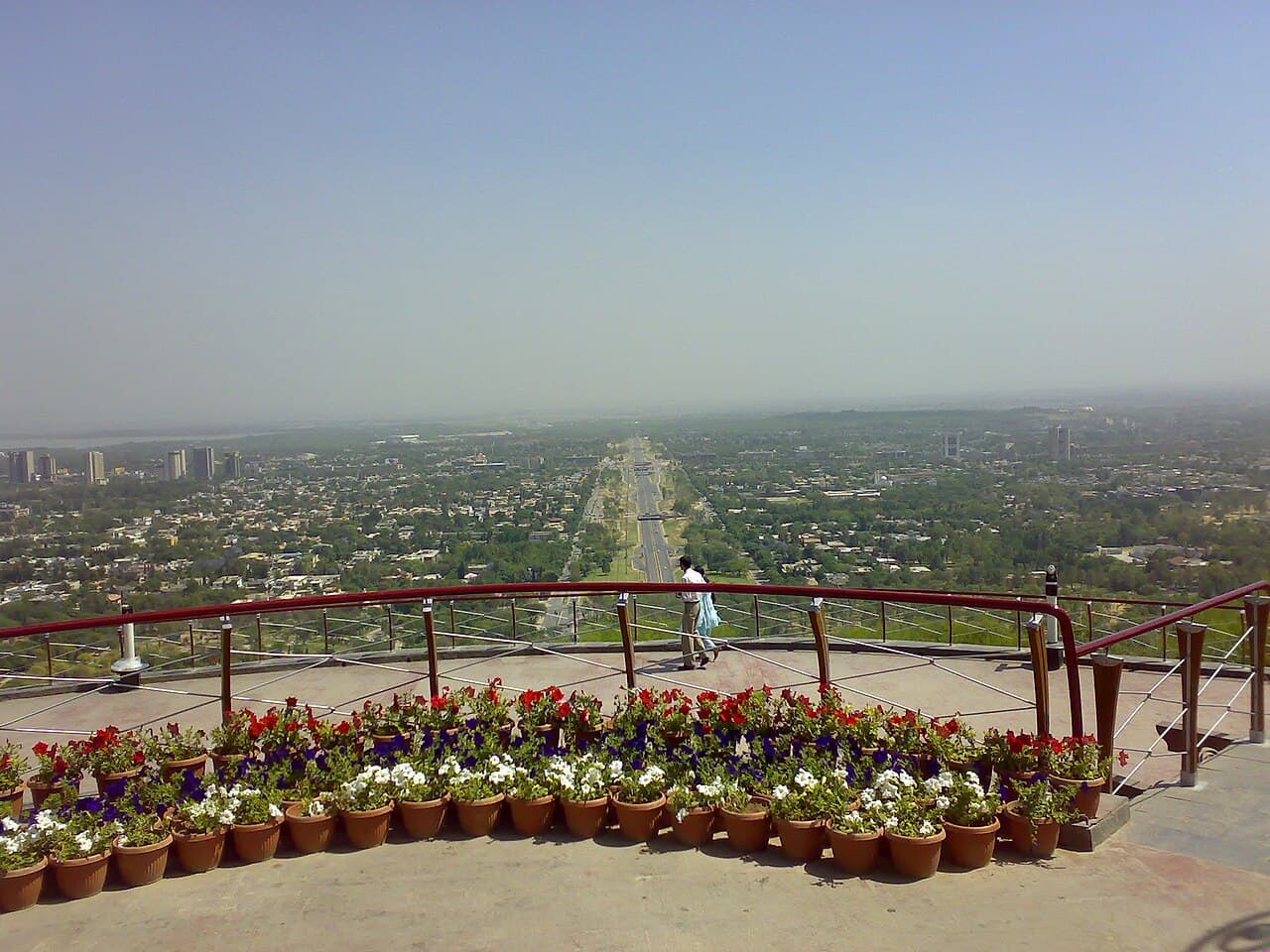
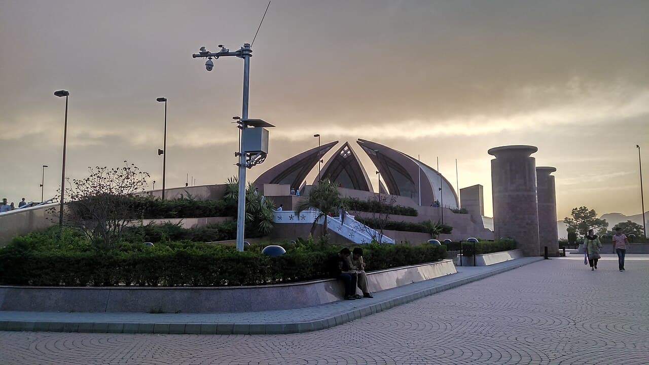
You do not need a specialist tour to see the structure. From a public viewpoint, identify the sector grid and green separations. In a markaz, look for the intended role of a central facilities area. Along a public Blue Area segment, notice the linear commercial form. Around Shakarparian and the Pakistan Monument, observe how national symbolism and landscape occupy a different scale from everyday neighbourhood life.
These are observation prompts, not a timed itinerary. Use only places currently open to the public and respect posted rules. Record what the built city actually shows, then compare it with the official plan's claims. The most revealing finding may be a mismatch: a difficult pedestrian link, a lively informal use or an institution that interrupts the tidy diagram. A planned capital becomes intelligible when the plan is treated as a proposition tested by decades of use.
- Grid: the repeatable city frame.
- Markaz: the neighbourhood centre idea.
- Blue Area: the linear business spine.
- Shakarparian: national institutions within a landscape setting.
Useful answers
Reader questions
Who designed Islamabad's master plan?
CDA records that the Federal Capital Commission appointed Doxiadis Associates and that the federal cabinet approved the master plan on 26 October 1960. The commission, statutory authority and regional context are part of the story too.
Sources: Capital Development Authority; Capital Development AuthorityWhy are Islamabad's neighbourhoods called sectors?
The grid divided the planned city into modular neighbourhood communities. Each sector was intended to organise central and local facilities within a repeatable unit, not merely provide an address code.
Sources: Capital Development Authority; Capital Development AuthorityWas Rawalpindi outside the original planning idea?
No. The official review says the original metropolitan concept included Islamabad, Rawalpindi, the national park and rural area, although later legal boundaries detached Rawalpindi and its cantonment from Islamabad's plan.
Sources: Capital Development Authority; Capital Development AuthorityIs Islamabad still exactly the city shown in the 1960 plan?
No. The official review documents zoning changes, unregulated growth, incomplete implementation and the need for updated regional planning. The founding structure remains visible, but the lived city has changed substantially.
Sources: Capital Development AuthorityRead the evidence
Sources and further reading
These sources support the relevant sections above. Plans and comparisons are editorial suggestions. Check operators for current arrangements.
- CDA-Planning & Design ↗Capital Development Authority · Research date 14 September 2026
The Federal Capital Commission, Doxiadis appointment, 1960 approval, grid-iron plan and sector-community concept.
- CDA-About Islamabad ↗Capital Development Authority · Research date 14 September 2026
Site-selection context, the relationship to Rawalpindi, original functional zones and the master-plan background.
- Interim Report on the Review of Master Plan of Islamabad (2020–2040) ↗Capital Development Authority · Research date 14 September 2026
The plan's chronology, metropolitan components, sector hierarchy, Blue Area, nature framework and documented implementation gaps.
- CDA Ordinance 1960 ↗Capital Development Authority · Research date 14 September 2026
CDA's establishment, statutory responsibilities and combined development and municipal objectives.
- CDA-Enviromental Protection ↗Capital Development Authority · Research date 14 September 2026
The present management layers for sector green areas, Shakarparian, parks, forests, viewpoints and watersheds.
- CDA-Destination ↗Capital Development Authority · Research date 14 September 2026
Official public context for Shakarparian, the Pakistan Monument and city viewpoints.